
 Printable PDF
 GPX Route
 Large Map

A group aiming to further walks and walking in and around Clare, Suffolk’s smallest town which is situated in the Stour Valley on the border with Essex.


Set on the river Brett, Hadleigh is a once royal Viking town and the reported burial place of Danish King Guthrun. It prospered in the 15th and 16th centuries through its cloth trade. Timber and plasterwork buildings line the High Street which is the backbone of the town. St Mary’s Parish Church, with its tall lead spire, is bordered by a magnificent 15th century Guildhall and red-brick Deanery Tower. The town has an eclectic mix of shops, services, restaurants, cafes and pubs that have a strongly independent feel.
 From the car park (which has public toilets) walk across the road and via an alleyway next to a Co-op supermarket into the High Street. Turn left and then right into Church Street and thence into St. Mary’s Churchyard. Go to the Tudor Gateway, turn left into the alleyway at the back of the Guildhall, alongside The Ram, into Duke Street and then cross Toppesfield Bridge.
 Bear right into Holbecks Lane. At Park Farm take the left fork up to the surfaced Love Lane.
 Turn right onto the Lane and follow it ahead for approx ¾ of a mile to a road (Coram Street). Turn left and stay on the left hand side. You will shortly come to a junction with a main road. Turn left and stay on the green verge on the southern side of the road. When you are opposite a hedge end on the north side of the road, cross over to a footpath (care: fast traffic).
 Follow the footpath down into Kersey Vale and cross a stream (over the bridge). Turn right along Vale Lane up into the village.
 Keep straight ahead, ignoring the road entering from the left. Beyond a road triangle with a tree, bear right and immediately left into the driveway to Kersey Primary School and the Parish Church via the lychgate.
Kersey is much photographed with a ford of the river Brett in the middle of the village. It is also where ‘the Magpie Murders’ TV series was filmed. The Parish Church is worth a visit if open; it has a rededicated medieval shrine, and a toilet in the tower.
 From the Church, descend the steep worn steps to the ford and beyond. As the road turns right take the footpath ahead and then turn left onto Lindsey Road. At the end of The Priory grounds, as the road bears left, turn right onto a footpath.
 Follow the path to the bottom of the slope, turning right into a field. Follow the hedge, turning right alongside a bank to the edge of a woodland.
 At end of the wood turn left cross the large field on the path which bears right by a small wood, then left to another wooded area.
 Turn right, following the path through the wood, and crossing a stream by a footbridge, and then left to meet a road. At the road turn right and stay ahead on this road through the staggered crossroads to the Lindsey Rose.
Suggested rest stop/break point (approximately 5 miles from Hadleigh). There is a large green area opposite the pub that makes for an excellent picnic and resting spot. Alternatively, the pub has the usual facilities.
Lindsey and Lindsey Tye represent a delightful rural location of mainly domestic housing but it is probably best to rest up and save remaining energy for the second part of the day (6 ½ miles).
 From The Lindsey Rose re-trace along the road to a junction by ‘The Old Forge’ cottage and take the right fork towards Monks Eleigh.
 Follow this road for just over a mile passing Boyton Hall. After Boyton Hall take the first road on the left towards Stackyard Green.
 When the road bends left take the footpath into the field on the right.
At the edge of the field, with Monks Eleigh church to the right, bear half left across the field (this may not be marked or may be marked with sticks). Keeping to this bearing, head over the horizon and drop down to a hidden sign and a new footbridge in the valley.
 Cross the bridge and head on the same bearing up the next field. Just before the end of the field take the path which drops very steeply down steps between gardens to emerge on a small lane (Back Lane, Swingleton Green).
 Turn left along the lane and then take a footpath on the right across a marshy area to arrive on the main road through Monks Eleigh.
 Look for the steps across the road, slightly to the left, up to Monks Eleigh Millennium Green (a delightfully peaceful area with benches). Go up the steps and bear right towards the Parish Church.
At the road turn left past the church and village hall. Stay on this road for about a mile, until you reach Hawkins Farm and Tye Farm where the road bends left.
 Leave the road and take the path on the right through a kissing gate between the two farms and keep ahead for approx. ½ mile.
 Turn left onto Nova Scotia Lane to reach a road. Turn left along the road and at the left bend in the road keep straight ahead on a green lane (Clay Lane).
 Continue for about a mile and a half to reach Clayhill Farm and a tarmac drive.
Follow this down to the bridge over the River Brett at the lower end of Lavenham. Bear left, then at the next junction go right into Water Street and keep ahead to the T junction (next to ‘The Swan’ hotel). If returning to the car park, turn left in the street towards the Parish Church on the right.
 If continuing onto Clare, turn right.
A detour to see the ‘Market Place’ will more than repay the effort. To get to the Market Place, from Water Street turn right into Lady Street and it is at the top of the hill. The Parish Church opposite the finish of the walk is also well worth visiting.

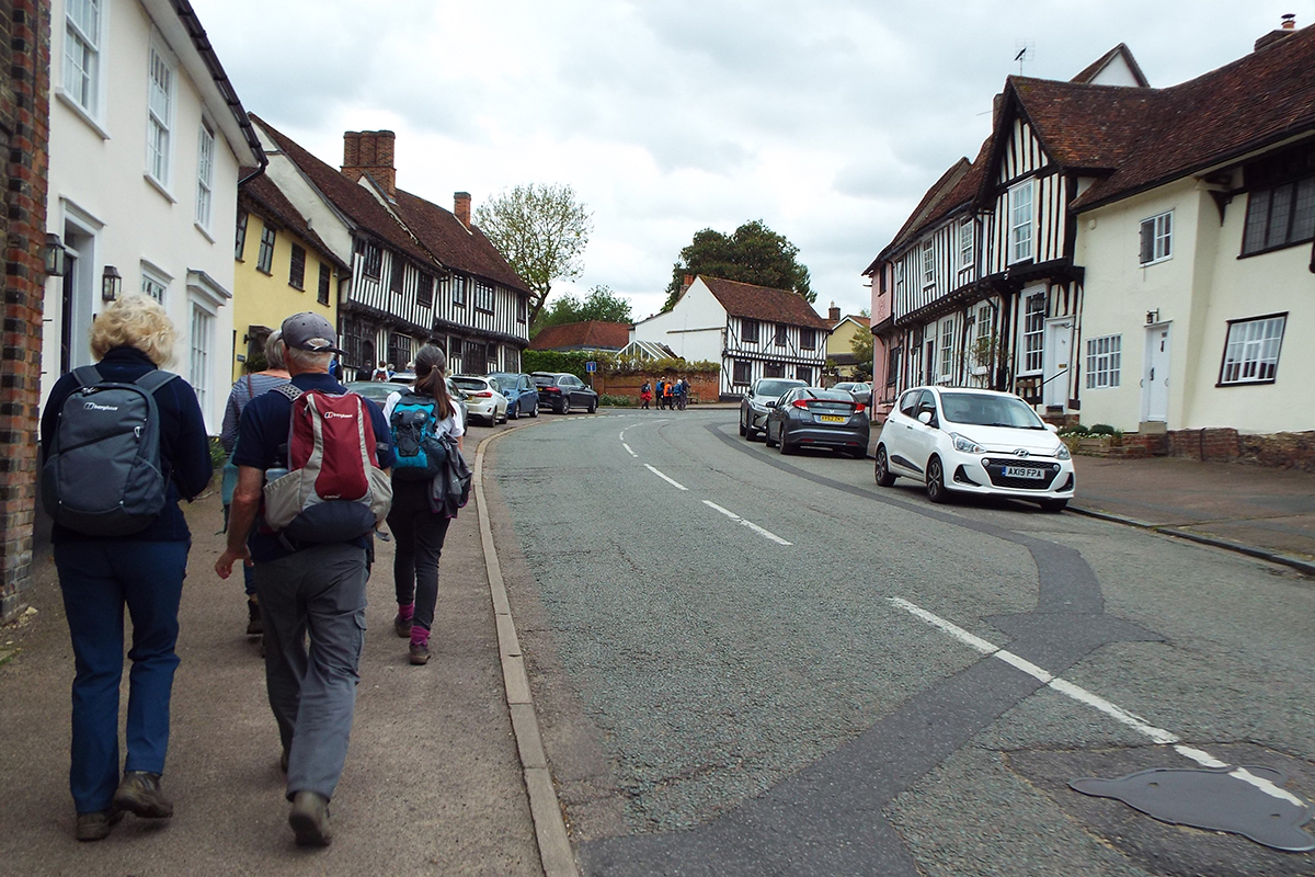

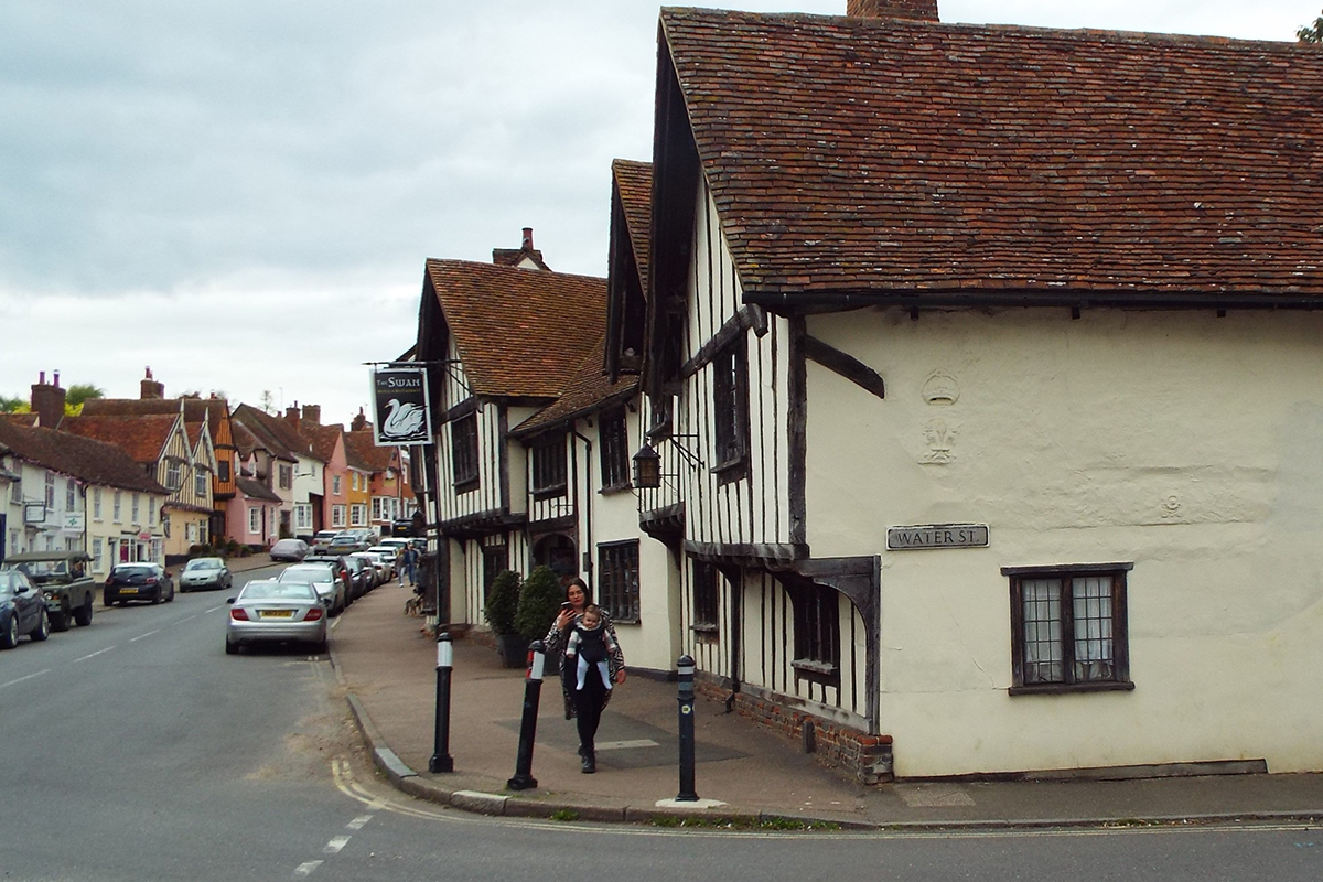
Lavenham is reputedly England’s best-preserved medieval town. It was a major centre of the wool trade and offers a wealth of historic interest, including a large number of listed timber-framed medieval buildings. It also has an impressive range of independent shops, galleries and places to eat and drink. The ‘Market Place’ containing the Corpus Christi Guildhall and Little Hall is well worth a visit, as is the magnificent medieval Parish Church of St Peter and St Paul.
Start:
Magdalen Road Car Park, Hadleigh, IP7 5EF
Finish:
Church Street Car Park, Lavenham, CO10 9SA
Possible break point:
Lindsey Tye IP7 6PP
A group aiming to further walks and walking in and around Clare, Suffolk’s smallest town which is situated in the Stour Valley on the border with Essex.

A charity whose aims are to encourage walking, to protect rights of way, to develop walks and to defend the beauty of the countryside for the benefit of all.

Promoting walking, cycling and riding in Suffolk. Explore walking, cycling and riding guides, promoted trails & easy access routes in Suffolk.

A nationwide initiative enabling the development of over 100 accredited Towns and Village members. Assisting with their communities’ economic, physical, health and mental well-being through walking.