
 Printable PDF
 GPX Route
 Large Map

A group aiming to further walks and walking in and around Clare, Suffolk’s smallest town which is situated in the Stour Valley on the border with Essex.

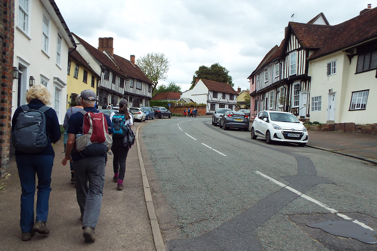

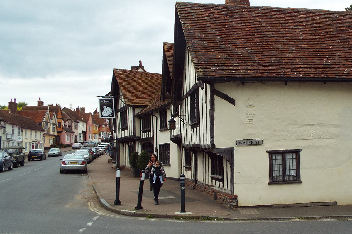
Lavenham is reputedly England’s best-preserved medieval town. It was a major centre of the wool trade and offers a wealth of historic interest, including a large number of listed timber-framed medieval buildings. It also has an impressive range of independent shops, galleries and places to eat and drink. The ‘Market Place’ containing the Corpus Christi Guildhall and Little Hall is well worth a visit, as is the magnificent medieval Parish Church of St Peter and St Paul.
 From the car park turn right into Church Street and then turn left just after the Swan Hotel into Hall Road. Follow the road as it bends left past some barns and take the footpath on the right through a gate.
 Continue ahead through another 2 gates and after another 300 yds emerge onto Bridge Street. Turn right along the road.
 After a little while, turn left onto a track towards Balsdon Hall Farm. Keep ahead to a path junction just before the farm buildings and turn half right along a track. Continue ahead on the track as it drops down towards a wood and a path junction slightly to the right of the track. Turn right and immediately left onto an enclosed woodland path, joining the St Edmund Way on an old railway track-bed.
 Keep ahead on the path, along the side of a meadow, re-enter woodland and cross a bridge over a stream to a T junction of paths at the edge of the wood.
 Turn left along the field edge, keeping to this field edge for approx. 400 yds where the path turns right going uphill to meet the main A134.
 Cross directly over (high speed traffic-great care) into Hare Drift track. Pass the garden centre to the road. Cross the road to enter through the gates of Kentwell Hall.
Suggested rest stop/break point (5 miles from Lavenham); Long Melford is to your left where a picnic on the Green or a visit to the shops and eateries in the main street make this the perfect location for a rest stop.


Long Melford is aptly named; at 1½ miles it has the longest village street in the country, lined with fine buildings, antique shops, galleries and places to eat and drink. The large village green to the north is dominated by the 16th Century Melford Hall (National Trust), home of the Hyde Parker family, and the impressive 15th Century Parish Church of the Holy Trinity which has cathedral-like proportions and contains surviving medieval stained glass of national importance. Nearby Kentwell Hall is renowned for its Tudor recreations and other events.
 Proceed through the gates and along the left-hand side of the main driveway.
 Just before the Hall take the path to the left. You are now on the Stour Valley Path for the rest of the walk. Go through 2 gates and just before the third take the path to the right through the meadow beside the hedge to a small metal chain gate. Take the track ahead for approx. 500yds.
 At a cross of paths and tracks take the path to the left beside the wood and continue on a field edge path. In the second field as the path starts to bend away take the cross field path to the right, signed Stour Valley path, towards an oak tree. Cross the footbridge, continue through the meadow and go to the right of farm buildings to a road.
 Turn right along the path at the field edge, take steps on your left onto the road (care) and take the path opposite beside a flint barn. Go between the gardens and cross a narrow footbridge over the River Glem. Cross the field ahead to another footbridge (note: after prolonged heavy rain the river can flood this field).
 Turn right along the field edge path to the corner of the field then turn left up the hill beside 3 fields to reach a road (Park Lane).
Just before the road turn back to see 3 church towers, to the left Glemsford, straight ahead Stanstead and to the right Long Melford.
 At the road turn left for a few yards and then take the path on the right, beside a field, toward the houses of Glemsford.
 Just before the houses, at a cross of paths, turn left and follow the path behind the houses to a road (Flax Lane). At the road turn right to a T junction.
Glemsford is an ancient village mentioned in the Domesday Book. It has a wool church and examples of medieval hall houses and weavers’ cottages and had both horsehair and silk weaving factories.
At the T junction turn left then right and take the narrow road beside The Angel pub.
 Follow this road to the end, continuing as it changes to a track. After a single house on the track at the corner keep straight ahead on a clear downhill path over 2 fields to a kissing gate in the hedge. Go through to the paddock and cross to the left corner of the next paddock to a double kissing gate.
Pass through and follow the fence down to a kissing gate, footbridge and steps to arable fields. Keep straight ahead crossing over 2 fields.
 At the hedge turn right for a few yards and go left through a large gap into another field. Continue ahead between fields. At a cross of paths, part way across the field, turn left (still following the Stour Valley Path) to a sports field. Go straight across the sports field to a narrow path between buildings and into Cavendish High Street.
 Turn right and walk along the village street to the village green.
Cavendish is one of the prettiest villages in Suffolk, with the view of the Green being a quintessential English village scene. It has associations with the Cavendish family (the Dukes of Devonshire) and Leonard, Lord Cheshire, and Sue Ryder are buried in the churchyard.
Turn diagonally right across the village green to the corner by the village school. Take the path between the cemetery and the school as it winds towards a field, go diagonally across to a plank bridge then straight on with the field on the left out to the road, all signed Stour Valley Path.
 Turn left along the road.
 Just past a house on the left turn left on the path, signed Clare, and follow the field edge path downhill.
Turn right across a plank bridge then left, cross a footbridge then turn right along the field edge. At the end of the field turn left on an uphill path between 2 fields going to the left of the hedge then back through the hedge onto the track and turn left.
 Follow this track to the top of the hill, past farm buildings, and keep straight on, going downhill. At the bottom continue on the path going uphill between 2 fields. At the corner of the field follow the path round to the left.
 After approx. 200 yards the path bears right through the hedge to emerge into another field (note; pause a while, there are fine views of Clare to be had from this viewpoint). Continue down the edge of this field towards a barn.
 Just before the barn take the path on the left between the field and hedge and after a short distance drop down to a wooded area that encloses the path. Continue on this path which leads past some buildings and a football field to a main road.
 Cross the road (care: traffic), turn right for a few yards and then take the narrow path beside Bridge House and a small graveyard into Clare Castle Country Park. Turn right and continue ahead to the children’s play area. Turn left across the grass and continue around the base of the castle motte towards the old station, now a cafe. At the old station turn right to the car park.
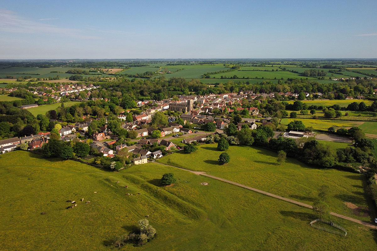
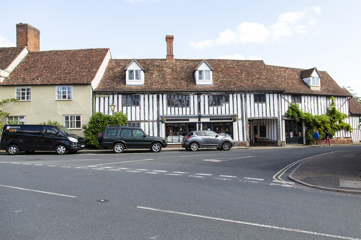

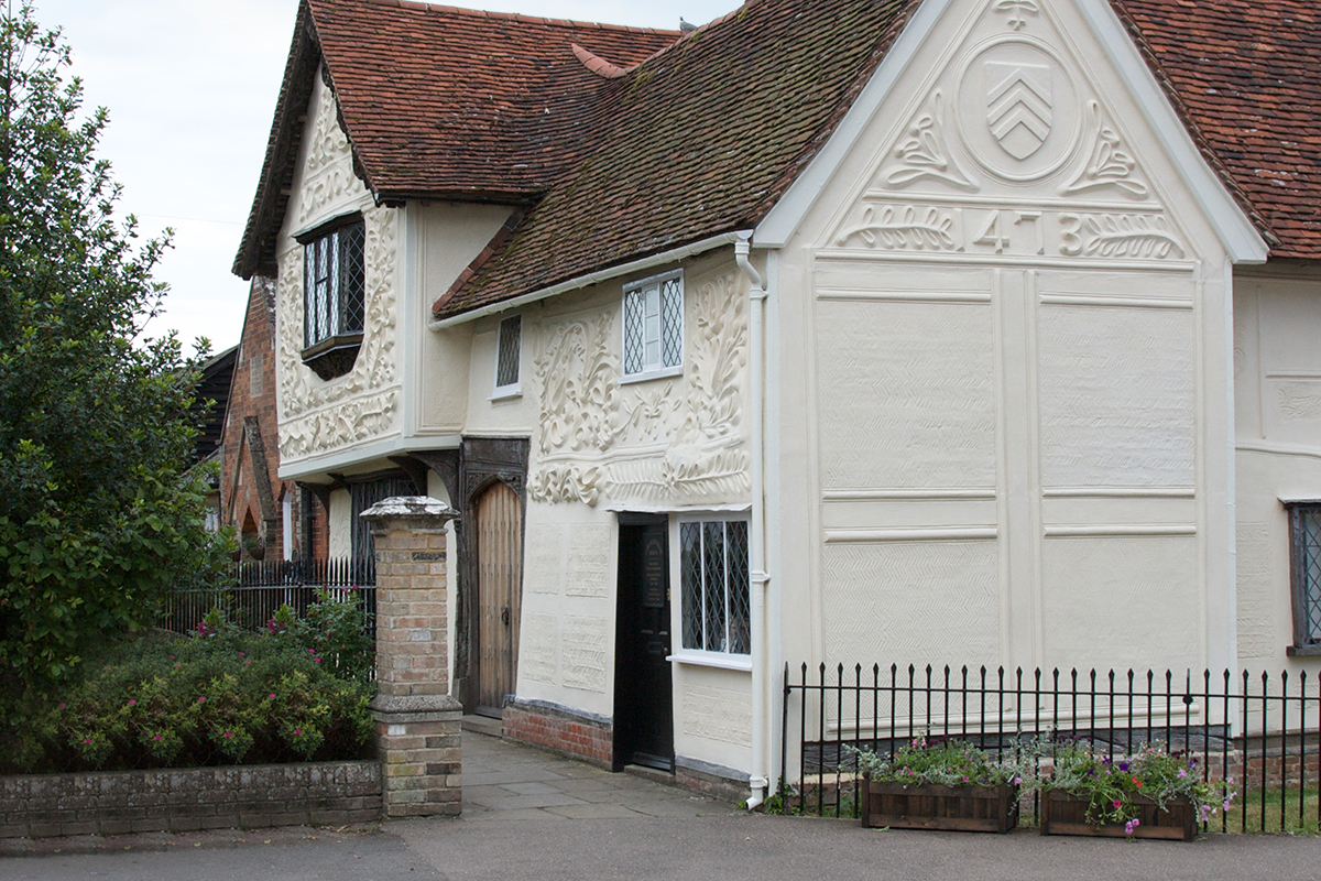
Nestling in the upper Stour Valley, Clare is Suffolk’s smallest town (population 2,300: 2021 census). It has a rich history: the de Clare’s were the richest non-royal family in England in the 14th Century. It has a 15th Century Wool Church, a Priory (the mother house in England of the Augustinian order), the ruins of a Norman motte and bailey castle, a country park, historic railway buildings, the pargetted Ancient House and the river Stour. With over 130 listed buildings and a range of independent shops, pubs, cafes and businesses it is well worth exploring.
Start:
Church Street Car Park, Lavenham, CO10 9SA
Finish:
Clare Castle Country Park Car Park, Clare, CO10 8NW
Possible break point:
Church Walk, Long Melford, CO10 9DLT
A group aiming to further walks and walking in and around Clare, Suffolk’s smallest town which is situated in the Stour Valley on the border with Essex.

A charity whose aims are to encourage walking, to protect rights of way, to develop walks and to defend the beauty of the countryside for the benefit of all.

Promoting walking, cycling and riding in Suffolk. Explore walking, cycling and riding guides, promoted trails & easy access routes in Suffolk.

A nationwide initiative enabling the development of over 100 accredited Towns and Village members. Assisting with their communities’ economic, physical, health and mental well-being through walking.